
Antiquarian Maps
Antiquarian maps provide some of the earliest evidence for historic county boundaries and shorelines, individual locations, town plans, and, more occasionally, principal roads. County and principal town maps before 1700 complement the modern interactive maps found elsewhere on this web site.
 Sizes in pixels500 x 391 (55K) 800 x 625 (121K) 1200 x 938 (331K) |
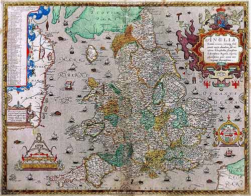
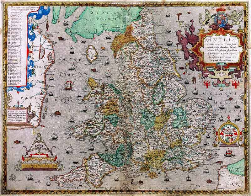
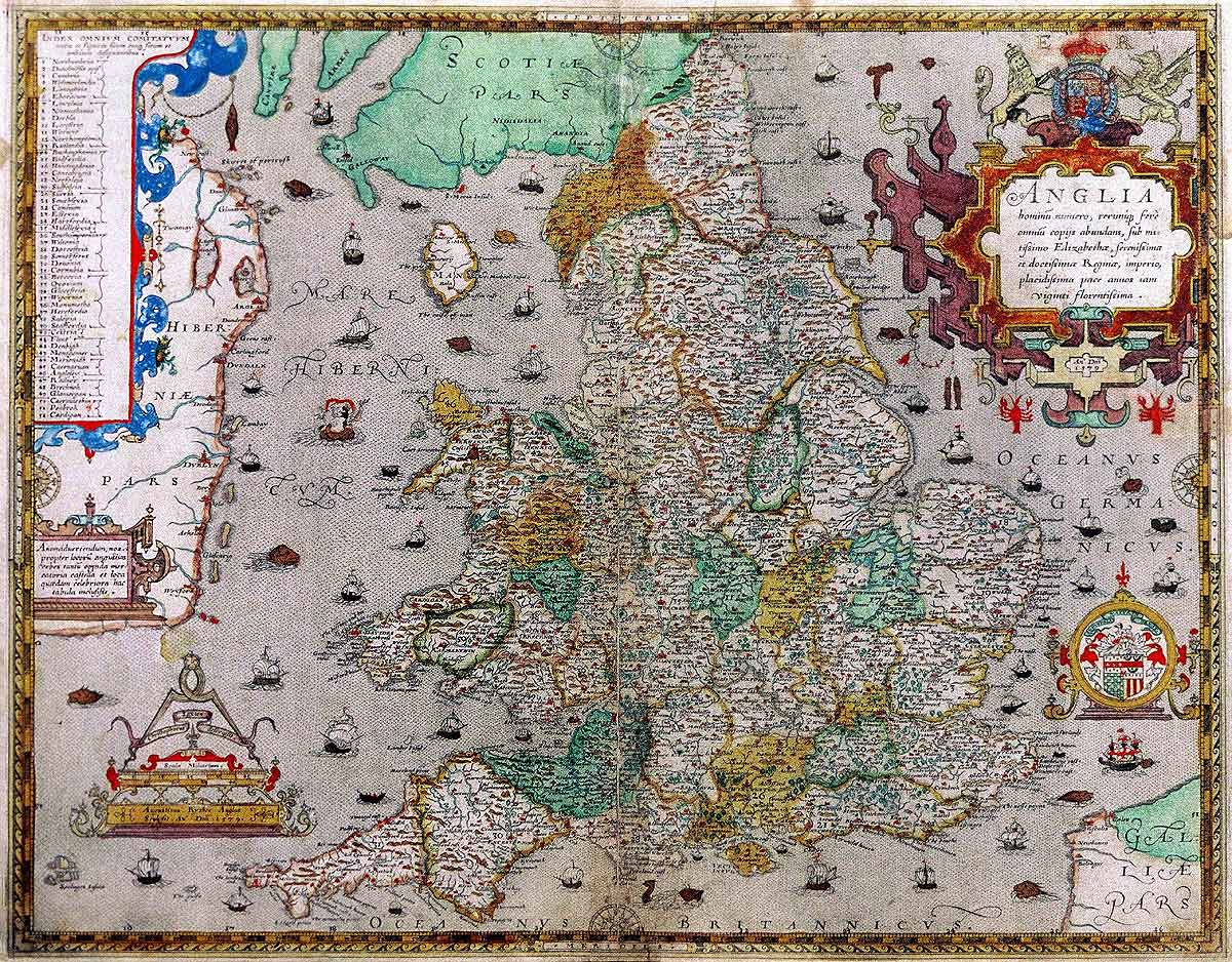
Map of England and WalesChristopher Saxton's map of England and Wales was first published in 1579 in an atlas of 35 coloured maps depicting the counties of England and Wales (STC: 21805.5). This volume is generally regarded as a landmark in British cartography and formed the basis for all succeeding county maps for over 100 years. Saxton's county maps were reissued and adapted until ca. 1778. Saxton was the first man to survey England and Wales, beginning in 1574, with county maps printed separately until completion in 1578. The general map 'Anglia' was engraved by the Englishman, Augustine Ryther. |
|
 Sizes in pixels500 x 354 (50K) 800 x 567 (96K) 1200 x 850 (195K) |
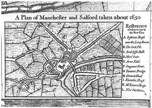
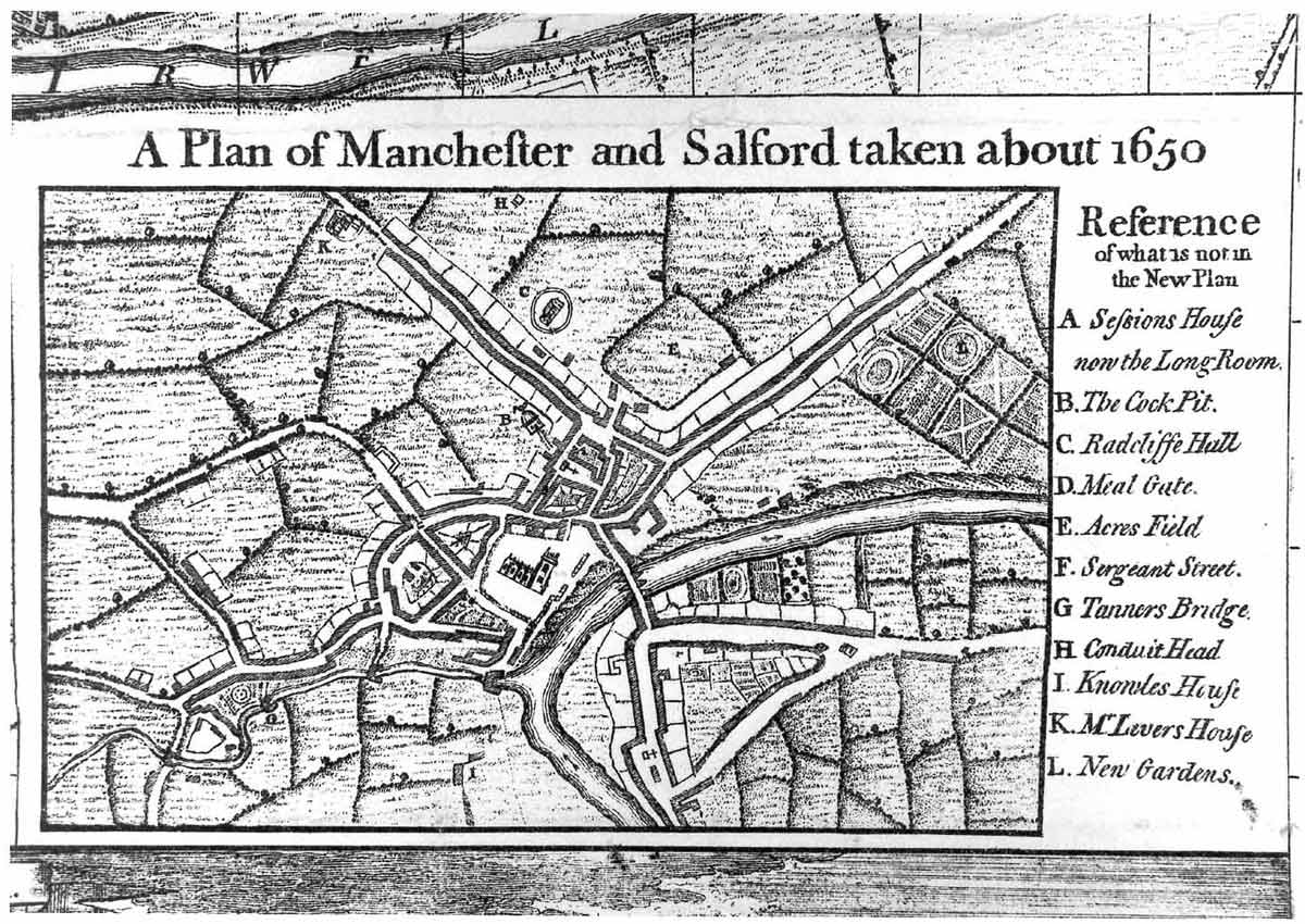
Map of Manchester ca. 1650One of the earliest known maps of Manchester, this town plan was inset in the 1746 edition of R. Casson and I. Berry's 'A plan of the Towns of Manchester and Salford in the County Palatine of Lancaster.' Item M2 5PD from the collection of the Manchester Archives & Local Studies Central Library. |
|
 Sizes in pixels500 x 393 (43K) 800 x 628 (135K) 1500 x 1178 (402K) |
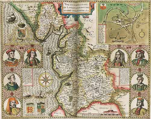
Map of LancashireJohn Speed's map of Lancashire was first published in 1611 as one of 44 English county and island maps included in The Theatre of the Empire of Great Britaine. The original model for this map was attributed to William Smith, an important contributor to the atlas. Typically for the period, there are no roads marked on the map, although there is a wealth of other handsomely depicted topographic information – woodlands, moors, rivers, market towns, private residences... The map of Lancashire also pays deference in its borders to the stability brought by the Tudor regime to a land troubled by warring claimants to the throne. Speed inserted portraits of seven Yorkist and Lancastrian monarchs, ending with Henry Tudor, and his bride, Elizabeth of York, a marital alliance that reconciled the two factions under Henry, as Henry VII in 1485. From The Theatre of the Empire of Great Britaine, 3rd edition (1616), STC: 23044. By permission of the Folger Shakespeare Library. |