The site of Sir Roger Manwood's house (here named Hales Place) to the NW of St Stephen's Church and the 18th c. house of Sir Edward Hales on a different site to the NE.
Reproduced from 'A Topographical Map of the County of Kent,' published in 1769.
'Hitherto Unknown Views' between 239 and 240
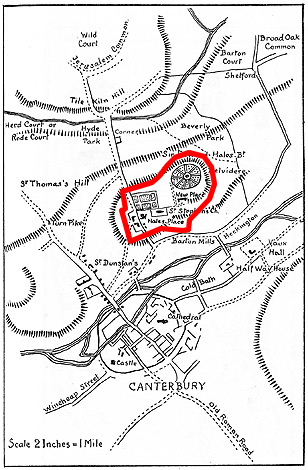
The site of Sir Roger Manwood's house (here named Hales Place) to the NW of St Stephen's Church and the 18th c. house of Sir Edward Hales on a different site to the NE.
Reproduced from 'A Topographical Map of the County of Kent,' published in 1769.